SkyforgeLabs Aerial site records Request a quote
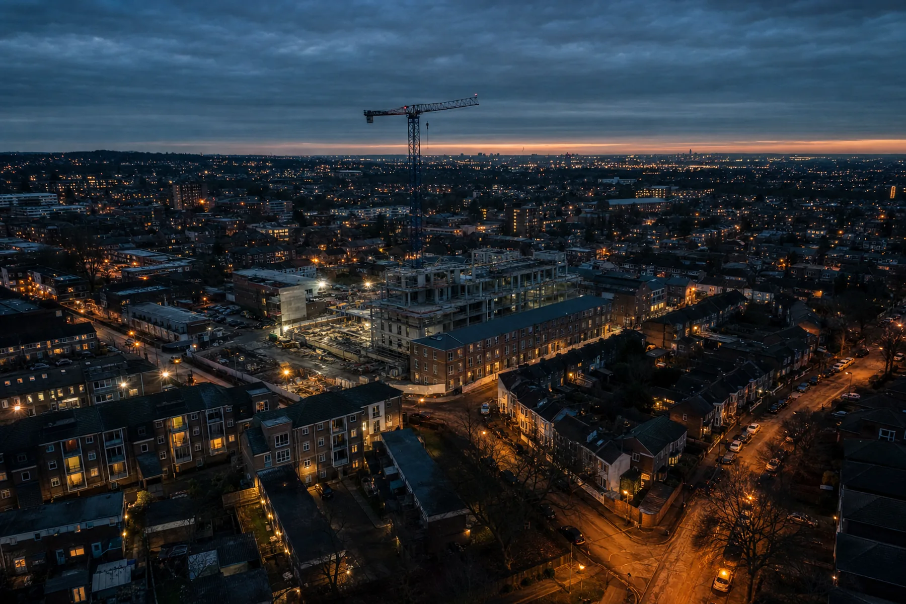
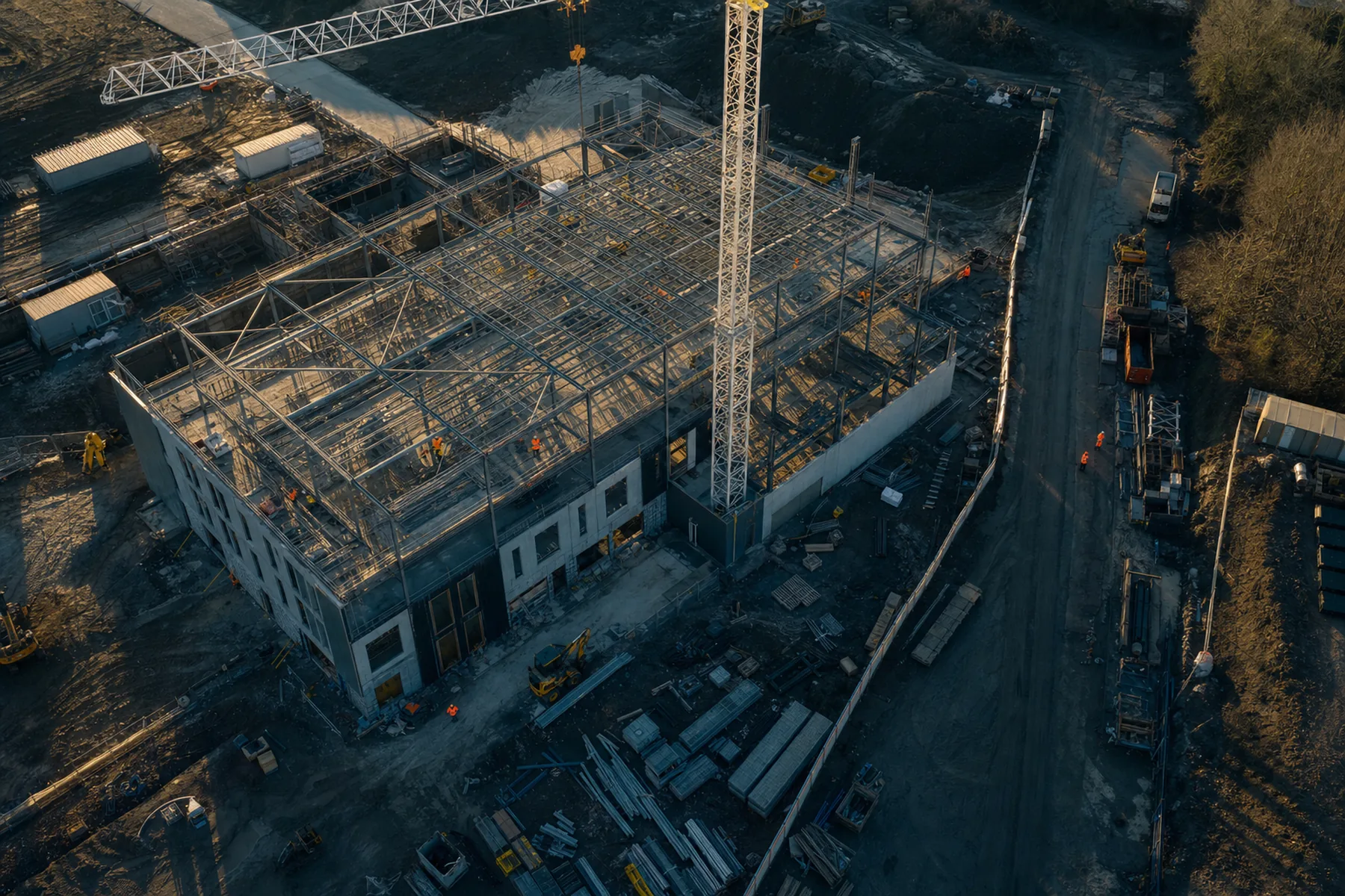
Aerial view of an active construction site at golden hour, steel frame and tower crane

London & the South East · CAA-registered drone operator

Eyes over your site
on a schedule.

Drone flights for construction progress monitoring, field scouting and property media. Every visit follows the same flight plan, so each set of images compares directly with the last. Edited files delivered within 48 hours.

  • 48 MPstills, RAW + JPEG
  • 4K / 30video, 80 Mbps
  • 48 hrsstandard turnaround
  • Free travelinside the M25

Why it matters

A photograph is presentation. A record is evidence.

Most aerial photography is a single set of images taken once. That serves a listing well, but it cannot demonstrate what the slab looked like on the 14th, or identify the area of a field that has been declining for three weeks.

Skyforge Labs flies the same routes, at the same altitudes, from the same take-off points, at a frequency you set. The result is client-ready imagery and a dated visual record you can rely on when a question is raised.

  • Repeatable flight plans — directly comparable frames from visit to visit
  • GPS-tagged, dated files organised by visit
  • A single point of contact from enquiry through to delivery

Services

Three core services.

Roof and gutter inspection follows shortly — details below.

Construction site from the air showing steel frame, materials laydown and site access road

01 / Construction & development

Progress monitoring visits

Weekly or fortnightly flights over your site from fixed positions, so progress images align frame to frame. Suited to client updates, valuations, subcontractor records, laydown planning and marketing the scheme during construction.

  • Fixed oblique set (four corners plus two elevations) and a nadir overview
  • Dated, GPS-tagged folder per visit, ready to drop into a report
  • Optional 30–60 second edit for client updates
  • Ground-level photography of specific areas on request

From £120 per visit on a weekly or fortnightly schedule
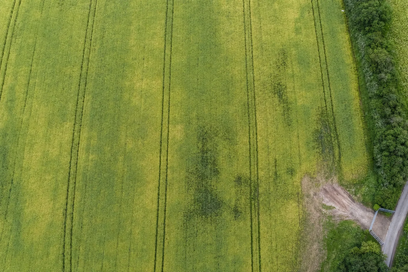
Straight-down aerial view of an arable field showing tramlines, pale patches and darker weedy areas

02 / Agriculture

Field & crop scouting

A regular overview of your fields so you know where to walk. I fly a nadir grid at a consistent altitude and flag anything irregular — thin or yellowing patches, weed pressure, standing water, damage along the wheelings, gaps in establishment, open gates, unauthorised tracks and fly-tipping.

  • Nadir overview of each field, stitched into a single flat image
  • Close frames of every area of concern, with an approximate location
  • A concise written note per field: observations and where to inspect
  • Repeat visits to establish whether an affected area is spreading

From £95 per visit, up to 40 ha in one trip

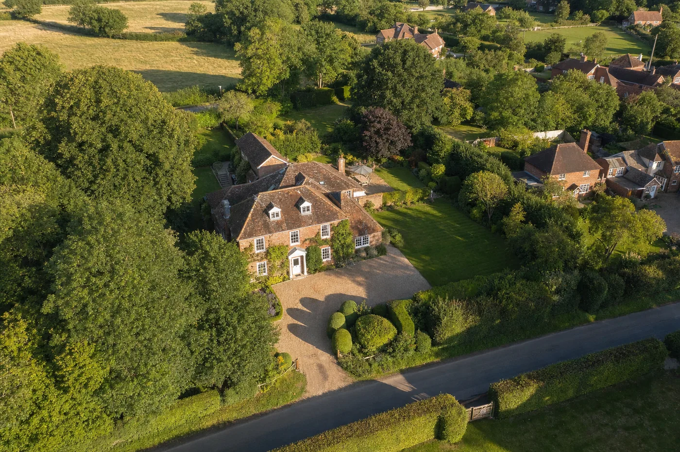
Aerial view of a detached brick house with large garden, gravel drive and mature trees

03 / Property

Property photos & video

Aerial stills and short video that present a property and its plot properly. Suited to instructions where the land, the setting, the roofline or the access matters as much as the interior — country houses, plots, barns, yards, developments and commercial units.

  • 10–15 edited stills, colour-graded and sized for portals
  • Optional 45–60 second video, edited for listings and social
  • Boundary and context frames showing plot, access and surroundings
  • Same-day delivery available for listing deadlines

From £150 stills · from £250 stills + video

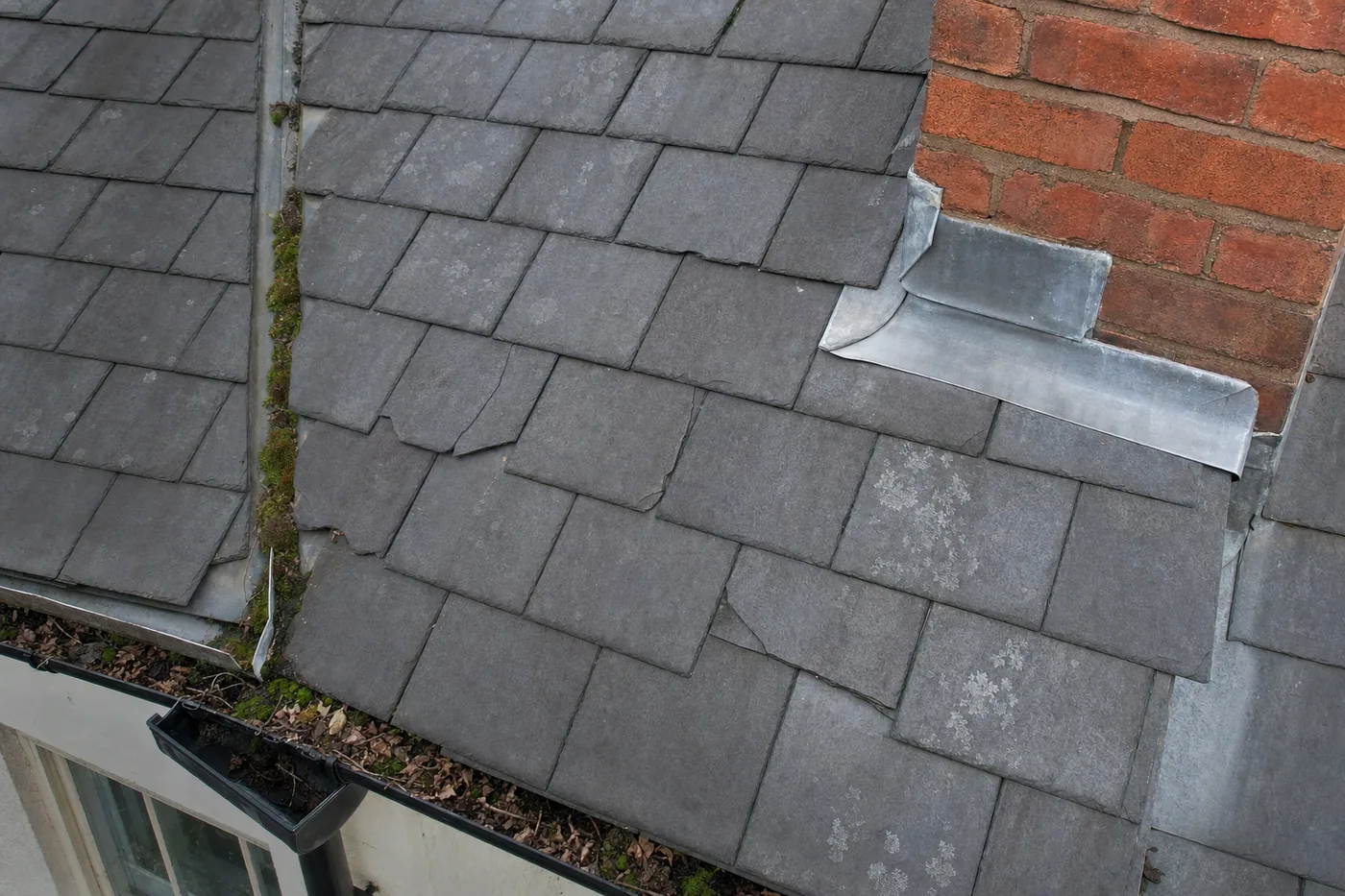
Close aerial view of a slate roof showing slipped tiles, moss in the valley and lead flashing at the chimney

Next up

Roof & gutter inspection

Close-range roof surveys — slipped and cracked tiles, flashing, chimney condition, blocked valleys and gutters — recorded from the air rather than from a ladder or scaffold. The service is currently in trial while the method and documentation are finalised. Register your interest and I will be in touch when it opens.

Register your interest →

Process

What a visit involves.

From booking to delivered files, usually within a week. Predictable by design.

  1. 01

    Brief

    A short call or email. Site address or postcode, the purpose of the images and the frequency required. If a location cannot be flown, you will know immediately.

  2. 02

    Airspace & access check

    I review the airspace, restrictions and ground risk around your location, then confirm take-off and landing points, who needs to be notified, and whether any permission is required before the day.

  3. 03

    The flight

    Typically 30–60 minutes on site. Repeat visits follow the same plan: identical take-off point, altitudes, headings and shot list. Work does not need to stop, and no supervision is required.

  4. 04

    Selection & edit

    Frames are culled to those worth keeping, then levelled, colour-corrected and exported. Anything soft, tilted or obstructed is not delivered.

  5. 05

    Delivery

    A dated folder link within 48 hours: full-resolution files, web-sized copies, video where booked, and a brief note on anything observed during the flight.

Deliverables

Exactly what you receive.

Delivered file formats and specifications
Stills8000 × 6000 JPEG, 48 MP · RAW (DNG) on request
Web copies2048 px long edge, sRGB, portal and social ready
Video3840 × 2160 at 25 or 30 fps, H.264 MP4, graded
MetadataGPS coordinates, altitude, date and time in EXIF
StructureOne dated folder per visit, sequential file naming
DeliveryDownload link, files kept live for 90 days
Turnaround48 hours standard · 24 hours or same-day rushes on request
LicenceUnlimited use across your own marketing, reports and listings

Technical detail

Equipment & method

Aircraft
Potensic ATOM 2 — 249 g MTOM, sub-250 g class
Sensor
1/2″ CMOS, 48 MP, f/1.8, ≈26 mm equivalent
Video
4K up to 30 fps at 80 Mbps, HDR and normal profiles
Gimbal
3-axis, −90° to +20° tilt for true nadir and obliques
Endurance
Up to ~32 min nominal per battery, spares carried
Category
UK Open Category A1, flown within visual line of sight
Registration
CAA Operator ID and Flyer ID held and current
Pre-flight
Airspace, NOTAM, weather and ground-risk check per site

The sub-250 g class is a practical advantage rather than a limitation: less disruption on and around your site, fewer restrictions in built-up areas, and a faster set-up than a heavier platform. Where a project genuinely requires survey-grade accuracy, photogrammetry or thermal imaging, I will say so and refer you to a specialist.

Pricing

Transparent starting prices.

Every project is quoted in writing before the flight, based on size, access and the level of editing required. The figures below are starting points.

Property

Stills pack

from £150

  • Up to 1 hour on site
  • 10–15 edited stills
  • 48-hour delivery

Property

Photo + video

from £250

  • 15 edited stills
  • 45–60 s graded video
  • Social crop included

Construction

Progress visit

from £120

  • Per visit, weekly or fortnightly
  • Fixed shot list, dated folders
  • Single visit from £180

Agriculture

Field scouting

from £95

  • Up to 40 ha in one trip
  • Overview + problem-area frames
  • Written note per field

Additional options: further edited stills, 24-hour delivery, RAW files, extended video edits and ground-level photography. Retainers of four or more visits per month are discounted — please ask.

Coverage

Inside the M25, travel is included.

There is no travel charge anywhere within the M25. Beyond it I still attend: travel is charged at £0.45 per mile from central London and quoted up front as a fixed figure, so there is no unexplained line on the invoice.

Regular work further out is usually cheaper still. On a weekly or fortnightly booking I build the travel into a flat per-visit rate and group nearby sites into the same run.

Check your postcode
  • Zone 1Inside the M25Greater London, all boroughs — no travel charge
  • Zone 2Up to 50 miles outSurrey, Kent, Essex, Herts, Berks, Bucks, Sussex — £0.45/mile
  • Zone 3Further afieldAvailable for multi-site or multi-day work, quoted per job

Restricted areas

Parts of London fall within controlled airspace or restricted zones, including the areas around Heathrow and London City, and over certain parks, prisons and government sites. Send the postcode and I will check it before you commit to anything. If a site cannot be flown lawfully, you will be told at the outset rather than after payment.

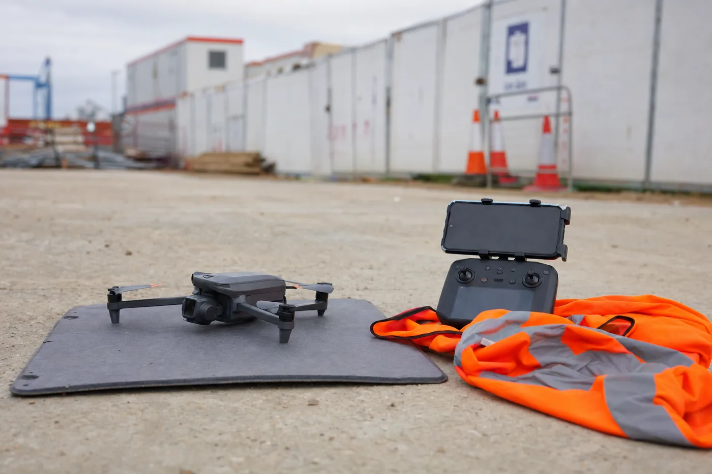
Folding camera drone on a launch pad beside a controller and hi-vis vest at the edge of a construction site

About

One operator, by design.

Skyforge Labs is a small, London-based aerial operation. You deal directly with the person who flies the aircraft, edits the images and issues the invoice, so nothing is lost between an initial enquiry and the day on site.

The aircraft is deliberately light and operated within the UK Open Category, which keeps set-up quick and disruption minimal. The method matters more than the equipment: a documented pre-flight check for your location, a fixed shot list, and files delivered named, dated and ready to use.

  • CAA Operator ID and Flyer ID held and current
  • Airspace, weather and ground-risk assessment before every flight
  • Site inductions, hi-vis, sign-in and RAMS documentation accommodated

FAQ

Common questions.

What happens if the weather turns?

In rain, low cloud or wind beyond the aircraft's limits the flight does not go ahead. There is no charge, and we move to the next available slot. On repeat bookings I will usually rearrange within the same week so your record stays consistent.

Do you need permission to fly over my site?

Permission is required from whoever controls the ground I take off from and land on, and I must maintain a legal separation from people not involved in the flight. Beyond that, most sites and fields require no special permit. Anything within controlled or restricted airspace is checked before quoting.

Will you disturb the workforce or the neighbours?

Very little. The aircraft is under 250 g and quiet, the flight lasts 30–60 minutes, and I operate from an agreed position at the edge of the site in hi-vis. No road closures, cherry pickers or scaffold.

How fast can I get the files?

48 hours as standard. 24-hour and same-day delivery are available for an additional fee, which is useful when a listing goes live or a progress report is due.

Can I use the images however I like?

Yes. You receive unlimited use of the delivered files across your own marketing, listings, reports and internal documentation. I retain the right to show the work in my portfolio, unless the site is confidential — in which case it remains private on request.

Is this a survey? Can I take measurements from it?

No. This is high-quality visual documentation rather than a measured survey. It is the right tool for progress records, identifying problems and marketing. Where survey-grade accuracy, volumetrics or orthomosaics are required, I will refer you to a specialist rather than overstate what this service does.

Do you do interiors or ground-level photography?

Ground-level exterior and detail photography, yes — it is often included. Full interior photography is not the core service, but ask and I will tell you honestly whether I am the right fit.

How do I book a regular slot?

Choose a frequency and a preferred day of the week. After the first visit the flight plan is retained and the slot recurs until you pause it. Visits can be cancelled or moved with 24 hours' notice at no charge.

Request a quote

Send the postcode and the purpose.

You will receive a fixed price, the first available slot, and confirmation that the location can be flown lawfully — usually the same day.

info@skyforgelabs.co.uk

  • Airspace and access check on every enquiry, free of charge
  • Fixed written quote before anything is booked
  • No charge if weather prevents the flight

This opens your email application with the details completed — nothing is sent until you press send.